A Bit About The Village
Ickleton is a village of some 650 people on the Cambridgeshire / Essex border in the U.K. It grew at the point where the ancient Icknield Way crossed the River Cam, so it is likely that some form of habitation has existed on the site since prehistoric times. However, the present layout of the village probably dates mainly from the late Saxon period.
History
There has been a settlement at Ickleton for at least two thousand years. The pre-Roman Icknield Way runs through the parish, and in Roman times there was a villa in the village, not far from the nearby Roman fort at Great Chesterford. The Domesday Book of 1087 shows that the village then had a population of about 250. By the time the railway arrived in 1845, the population had grown somewhat and today Ickleton is home to about 650 people.
The wonderful British History On-line project includes a comprehensive (15,000 words + footnotes) history of the village. To view it, click here.
Location
Cambridge lies about 12 miles to the north, and Saffron Walden about 5 miles to the south. The river Cam (or Granta) forms the eastern border of the village. Houses are mainly grouped around three streets, Abbey Street, Frogge Street, and Church Street, which leads into Brookhampton Street. The village itself lies at the eastern end of the parish which stretches for two miles to the west amidst rolling farmland.
Economy
Throughout its history, agriculture and related trades have been virtually the only economic activity. It was only after World War II that farming ceased to predominate. Today, Ickleton’s farms are hugely more productive than they were, even in the 1940s, yet they employ only a small number of people. Like many other rural villages, most of the working population is now employed elsewhere, in Cambridge, other towns nearby, or in London.
There are a few small businesses in the village, as well as a pub and a village shop. The Sanger Centre, home to the Wellcome Trust’s Genome Centre, is in Hinxton, less than one mile away.
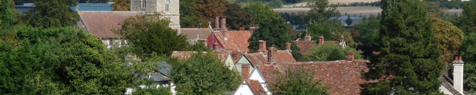
Architecture
The focal point of the village is its parish church, which is undoubtedly one of the most important in East Anglia. It dates from the 11th Century and contains a series of early wall paintings of the 12th and 14th Centuries revealed after a serious fire in 1979.
Communications
Communications from the village are outstanding. Access to the M11 is just a mile away, and London and Cambridge are therefore quickly accessible by road. Both the A1 (northwards) and the A14 (east to Ipswich, west to Birmingham) can easily be reached from the M11.
The Cambridge – London, Liverpool Street railway line runs to the east of the village. Train services run from Great Chesterford station (1 mile), Whittlesford (2 miles) and Audley End (5 miles) to Liverpool Street, Stansted, Cambridge and Kings Lynn. There are also frequent trains from Royston to Kings Cross.
There is a bus service to Cambridge and Saffron Walden.
As for air travel, Stansted is 20 miles away whilst Luton is 25 and Cambridge airport only 15.